


Use digital elevation data to create a relief map
How to CNC machine a topographic relief model in wood
Creating a geographic relief model. The complete process is shown, including data download, for this San Francisco relief model (DP V6, 14 min)
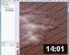
The San Francisco relief model video shows you how you can create geographic relief models with DeskProto. All steps in the process are shown:
- obtain free digital elevation data
- convert that to a standard bitmap file
- create a relief by converting grey values to Z-heights
- machine a relief model using DeskProto.
The nice thing is that you can do this for any part of the USA.
More information, including download links for software and for other parts of the world, on the Gallery page San Francisco relief model.
This video applies to all edition of DeskProto. However: it has been recorded using DeskProto V6, and since DP V7 the bitmap settings have been relocated from the Operation parameters to the Part parameters. The newer video about the Silicon Valley relief shows this in DeskProto V7.1